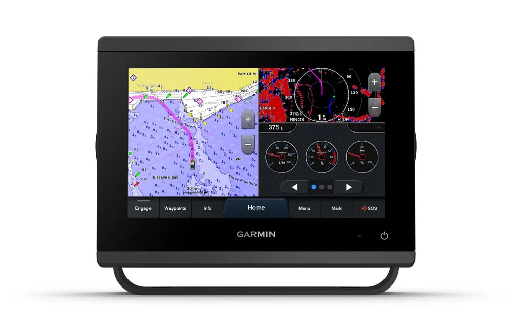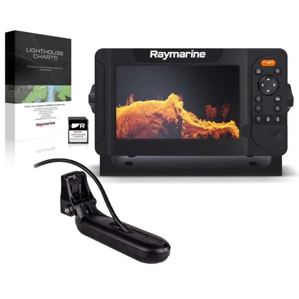

Garmin GPSMAP 723XSV Chartplotter
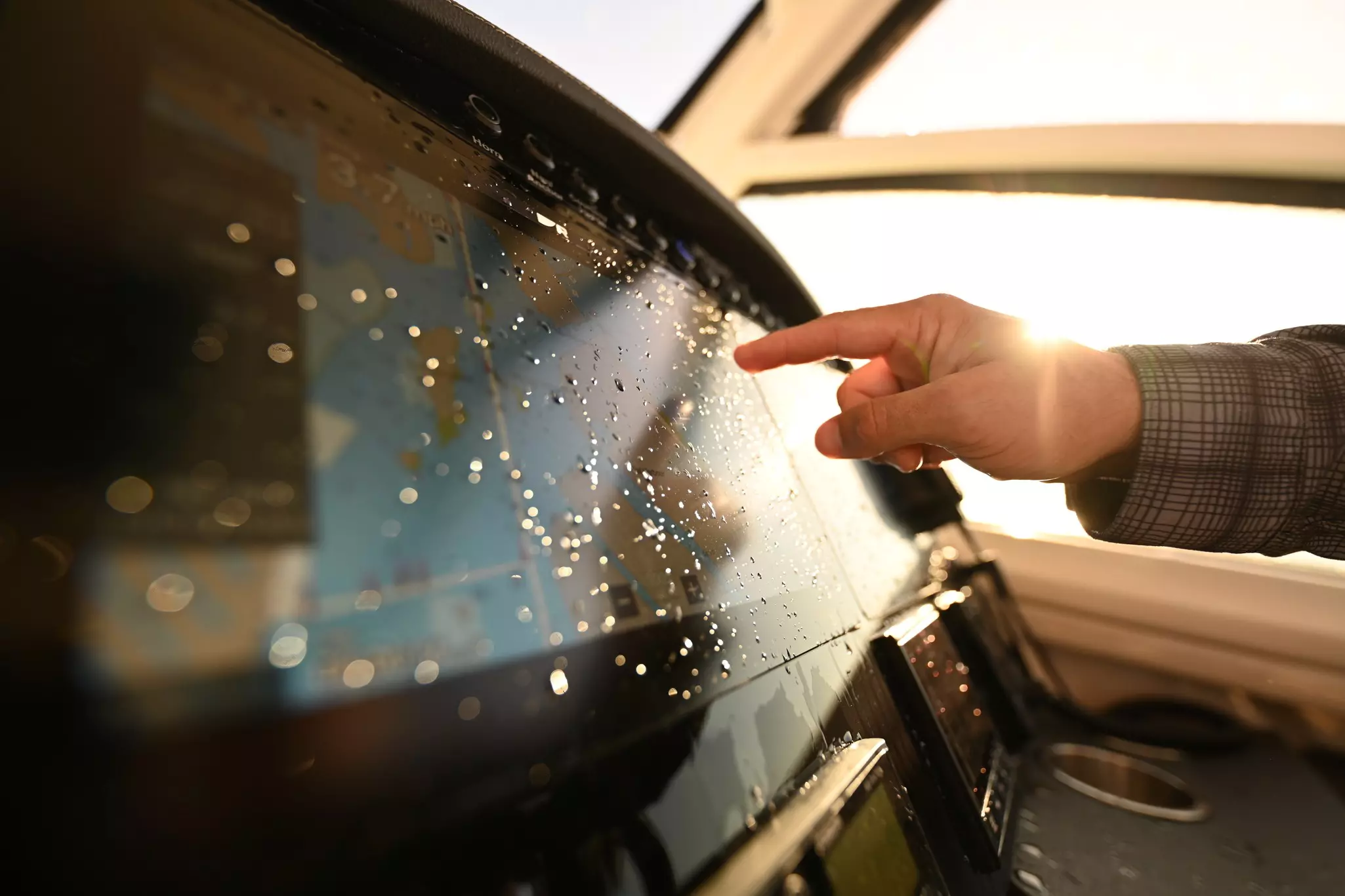
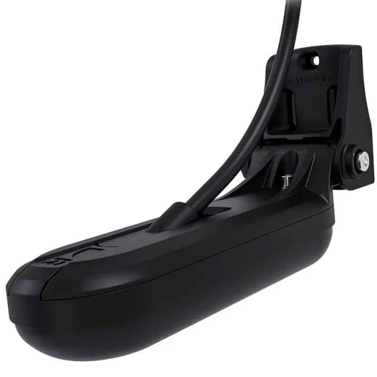
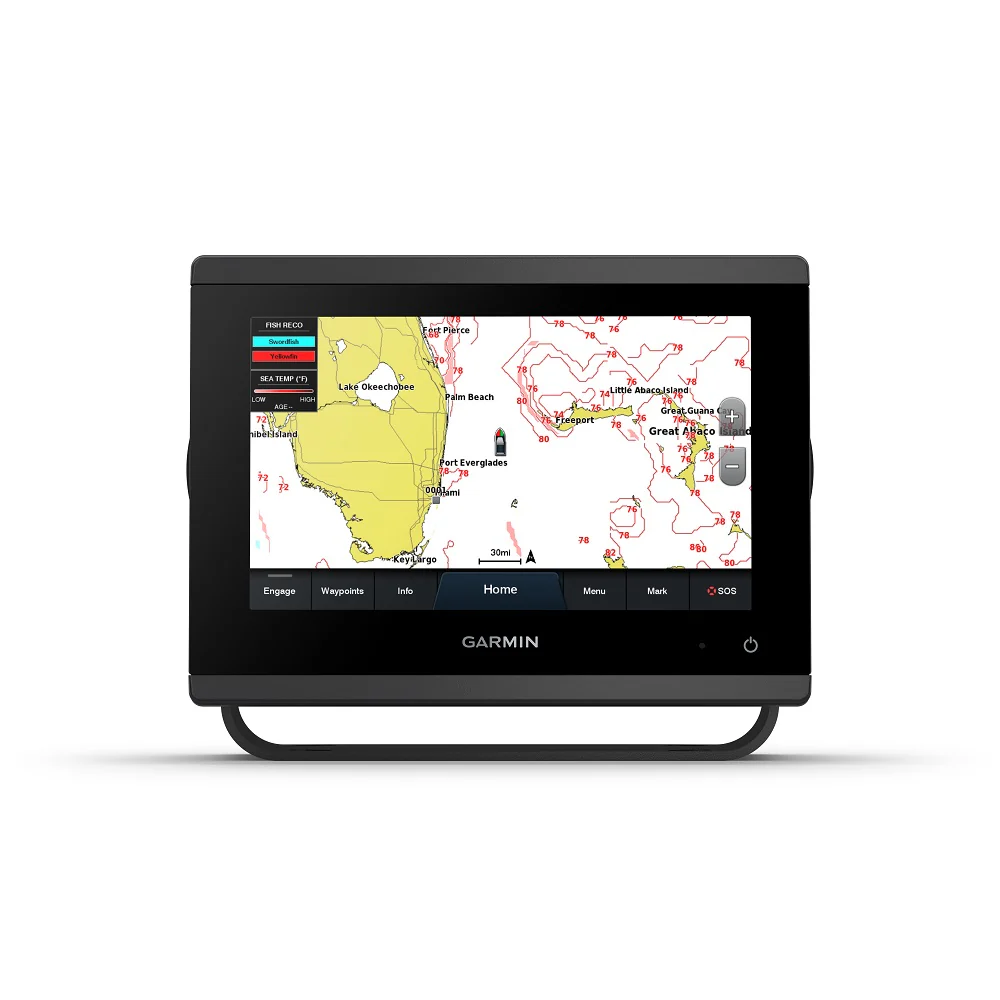
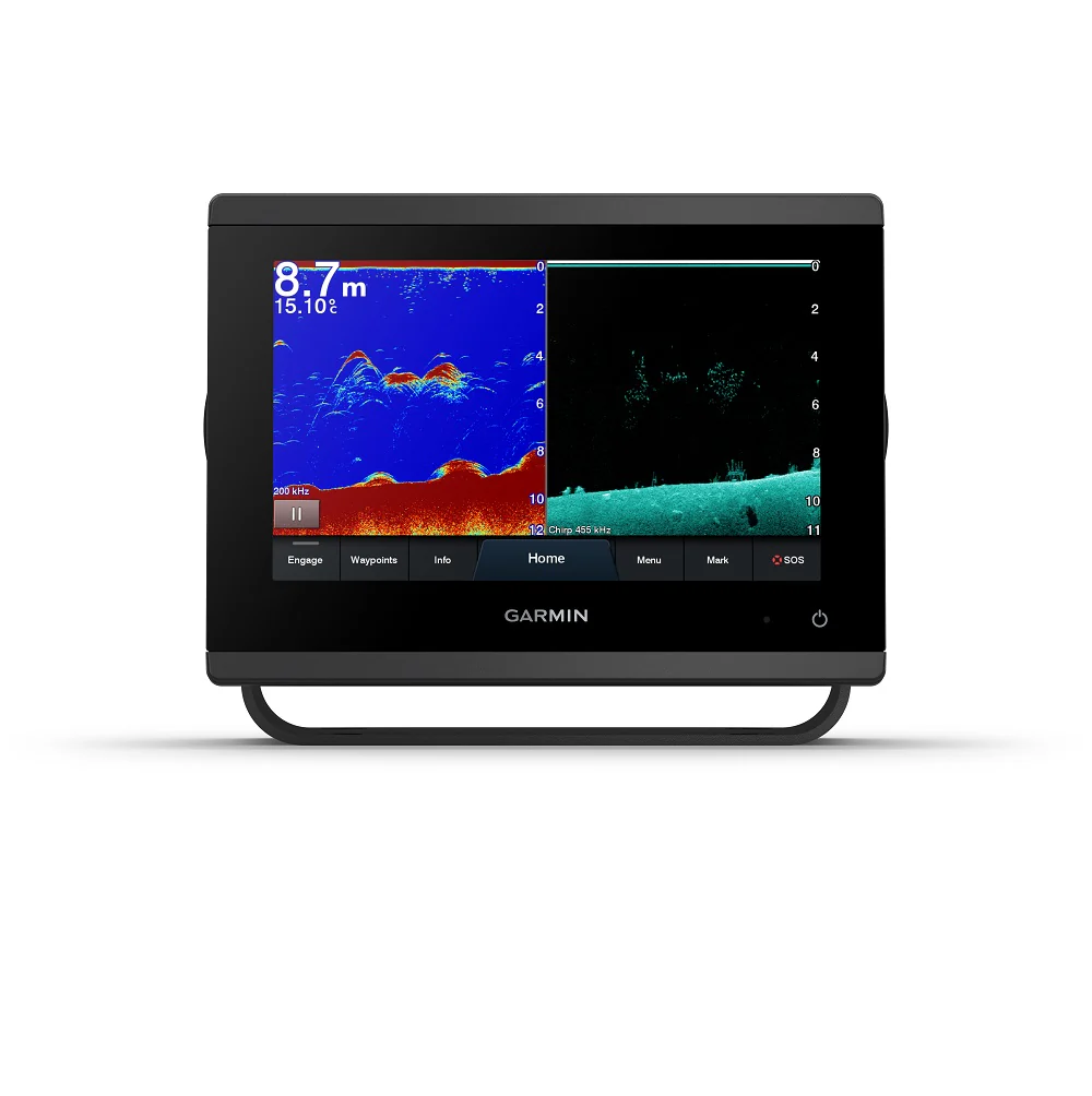
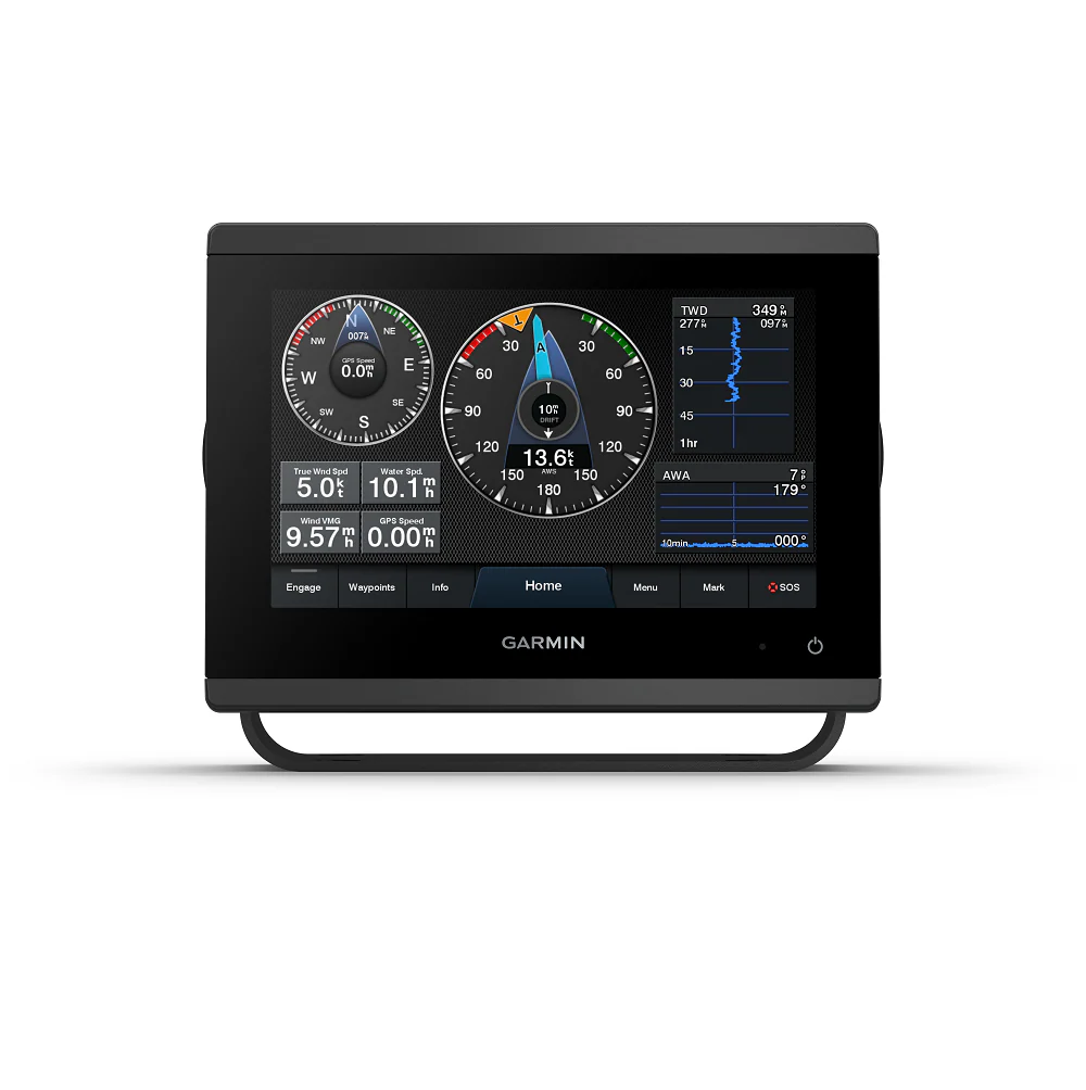
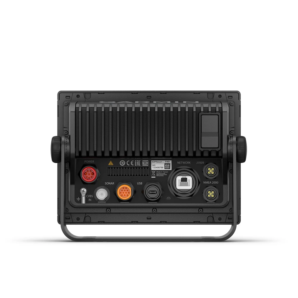
Get a sharper view from your connected helm with the GPSMAP® 723xsv chartplotter. Its higher-resolution 7” display has 60% more pixels than previous-generation touchscreens. And with its compact footprint, vivid sonar color palette and nearly double the processing power of previous-generation GPSMAP devices, it seamlessly integrates into your Garmin marine system — with support for optional charts and Auto Guidance1 technology to add confidence in helping you get where you need to go. GPSMAP 723xsv also features built-in Ultra High-Definition SideVü and ClearVü scanning sonars and supports 1 kW CHIRP traditional sonar as well as fully networkable radar and Panoptix LiveScope™ sonar devices. Easily build your marine system — from compatible sonar and autopilots to compatible radar, cameras and multimedia — using HTML 5.0, NMEA 2000® and NMEA 0183 network connectivity, J1939 for engines and the Garmin Marine Network. See RPMs, fuel flow, temperature, trim and more for up to four compatible Mercury engines by using the SmartCraft Connect gateway. Or pair your plotter with your other compatible Garmin devices, such as quatix® marine smartwatches, wind transducers, wireless remote controls and more.
- New higher-resolution touchscreen displays offer improved sunlight readability with 60% more pixels than previous-generation 7” units
- Fast and responsive, with nearly twice the processing power of previous-generation GPSMAP® devices, this system references 10 Hz GNSS (GPS, GLONASS and Galileo) for accurate positioning and smooth speed as well as COG data
- Slimline display borders, edge-to-edge glass and reduced unit footprint make for easy retrofit in a wider range of dash configurations
- Supports optional BlueChart® g3 charts with the best of Garmin and Navionics® data plus Auto Guidance¹ technology for confidence in helping you get where you need to go
- See RPMs, fuel flow, temperature, trim and more for up to four compatible Mercury engines by using the SmartCraft Connect gateway
- Our exclusive OneHelm™ feature for connecting to compatible third-party devices, such as EmpirBus™ digital switching
-
Easily build your marine system — from compatible sonar and autopilots to compatible radar, cameras and multimedia — using NMEA 2000® and NMEA 0183 network connectivity and the Garmin Marine Network
• Use built-in Wi-Fi® networking to pair with the free ActiveCaptain® app2 for access to OneChart™, smart notifications, software updates and more - Integrated ANT® technology support for use with your compatible quatix® marine smartwatches, gWind™ Wireless 2 transducer, GNX™ Wind marine instrument and wireless remote controls
- Built-in Ultra High-Definition SideVü and ClearVü scanning sonars with high-contrast vivid color palettes to help distinguish fish from structure
- Supports Panoptix™ and Panoptix LiveScope™ sonar devices, 1 kW CHIRP traditional sonar and more
--------------------------
1Auto Guidance is for planning purposes only and does not replace safe navigation operations
2Requires app on your compatible smartphone; see Garmin.com/ble
Product Information
Product Information
Shipping & Returns
Shipping & Returns
Description
Get a sharper view from your connected helm with the GPSMAP® 723xsv chartplotter. Its higher-resolution 7” display has 60% more pixels than previous-generation touchscreens. And with its compact footprint, vivid sonar color palette and nearly double the processing power of previous-generation GPSMAP devices, it seamlessly integrates into your Garmin marine system — with support for optional charts and Auto Guidance1 technology to add confidence in helping you get where you need to go. GPSMAP 723xsv also features built-in Ultra High-Definition SideVü and ClearVü scanning sonars and supports 1 kW CHIRP traditional sonar as well as fully networkable radar and Panoptix LiveScope™ sonar devices. Easily build your marine system — from compatible sonar and autopilots to compatible radar, cameras and multimedia — using HTML 5.0, NMEA 2000® and NMEA 0183 network connectivity, J1939 for engines and the Garmin Marine Network. See RPMs, fuel flow, temperature, trim and more for up to four compatible Mercury engines by using the SmartCraft Connect gateway. Or pair your plotter with your other compatible Garmin devices, such as quatix® marine smartwatches, wind transducers, wireless remote controls and more.
- New higher-resolution touchscreen displays offer improved sunlight readability with 60% more pixels than previous-generation 7” units
- Fast and responsive, with nearly twice the processing power of previous-generation GPSMAP® devices, this system references 10 Hz GNSS (GPS, GLONASS and Galileo) for accurate positioning and smooth speed as well as COG data
- Slimline display borders, edge-to-edge glass and reduced unit footprint make for easy retrofit in a wider range of dash configurations
- Supports optional BlueChart® g3 charts with the best of Garmin and Navionics® data plus Auto Guidance¹ technology for confidence in helping you get where you need to go
- See RPMs, fuel flow, temperature, trim and more for up to four compatible Mercury engines by using the SmartCraft Connect gateway
- Our exclusive OneHelm™ feature for connecting to compatible third-party devices, such as EmpirBus™ digital switching
-
Easily build your marine system — from compatible sonar and autopilots to compatible radar, cameras and multimedia — using NMEA 2000® and NMEA 0183 network connectivity and the Garmin Marine Network
• Use built-in Wi-Fi® networking to pair with the free ActiveCaptain® app2 for access to OneChart™, smart notifications, software updates and more - Integrated ANT® technology support for use with your compatible quatix® marine smartwatches, gWind™ Wireless 2 transducer, GNX™ Wind marine instrument and wireless remote controls
- Built-in Ultra High-Definition SideVü and ClearVü scanning sonars with high-contrast vivid color palettes to help distinguish fish from structure
- Supports Panoptix™ and Panoptix LiveScope™ sonar devices, 1 kW CHIRP traditional sonar and more
--------------------------
1Auto Guidance is for planning purposes only and does not replace safe navigation operations
2Requires app on your compatible smartphone; see Garmin.com/ble