Navionics Chart Card
Navionics Chart Card
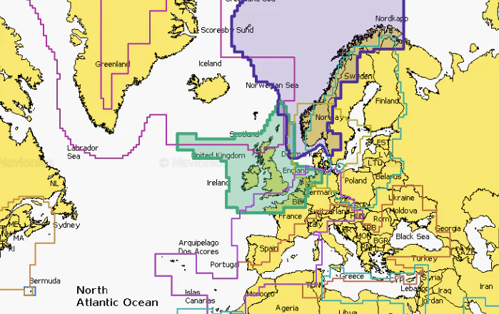
Navionics+ cartography provides integrated offshore and inland marine mapping content with rivers, bays and more than 42,000 lakes around the world. This all-in-one solution offers clear, reliable cartography for the widest range of chartplotter brands.
One Year Subscription Included
A one-year subscription to Daily Updates and advanced features is included when you purchase any Navionics+ mapping solution. After a year, you can renew at a discounted price.
Charts and Updates
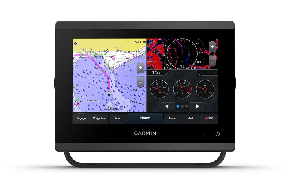
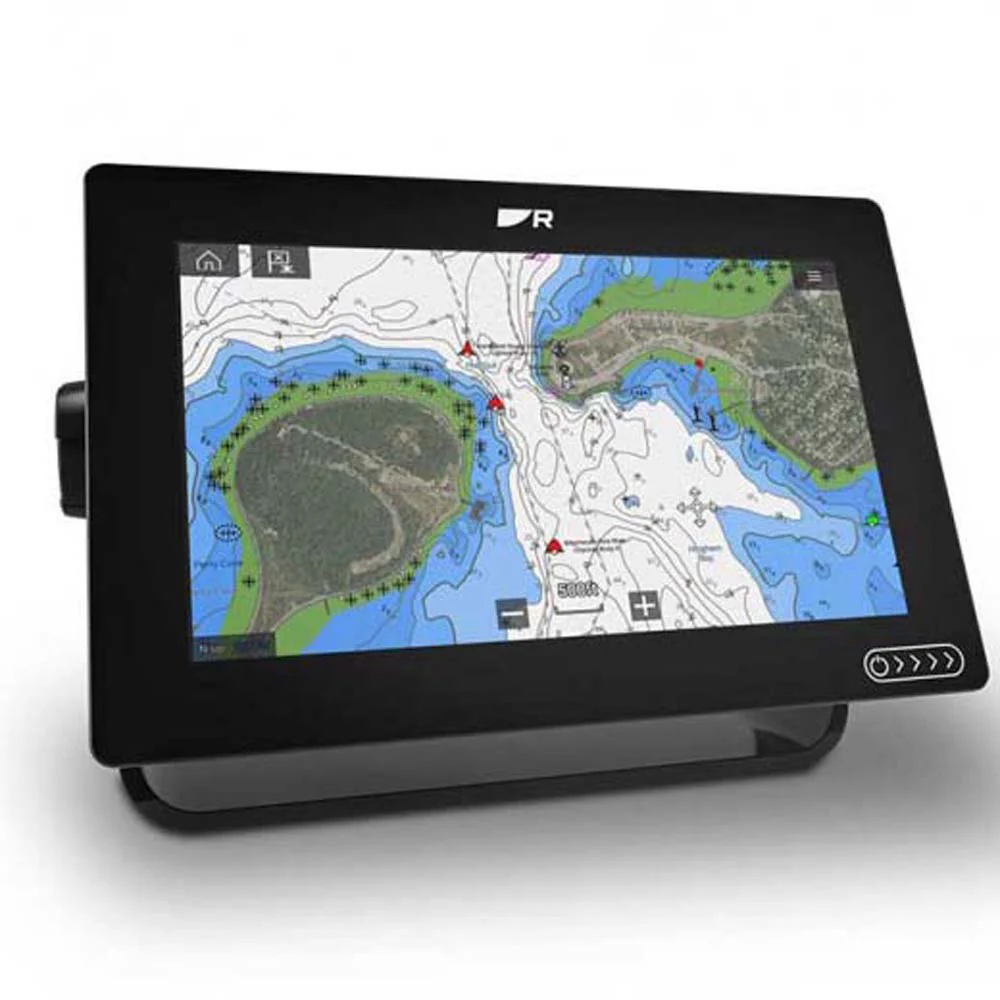
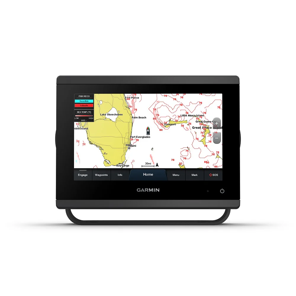
Nautical Chart – Comprehensive charts are derived from multiple official, government and private sources, displayed in a familiar look and feel.
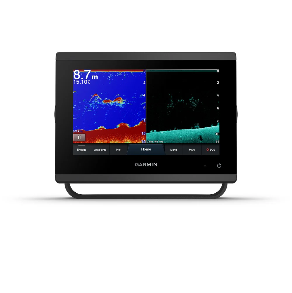
SonarChart HD Bathymetry – Innovative 1' (0.5 m) bathymetry charts are created by using Navionics proprietary systems that augment existing content with sonar data contributed by the boating community.
Community Edits – Get useful local knowledge from edits made by users of the Navionics Boating app on your compatible smart device.
Daily Updates – Up to 5,000 daily updates to our charts give you the most accurate, most current data available.
Advanced Features
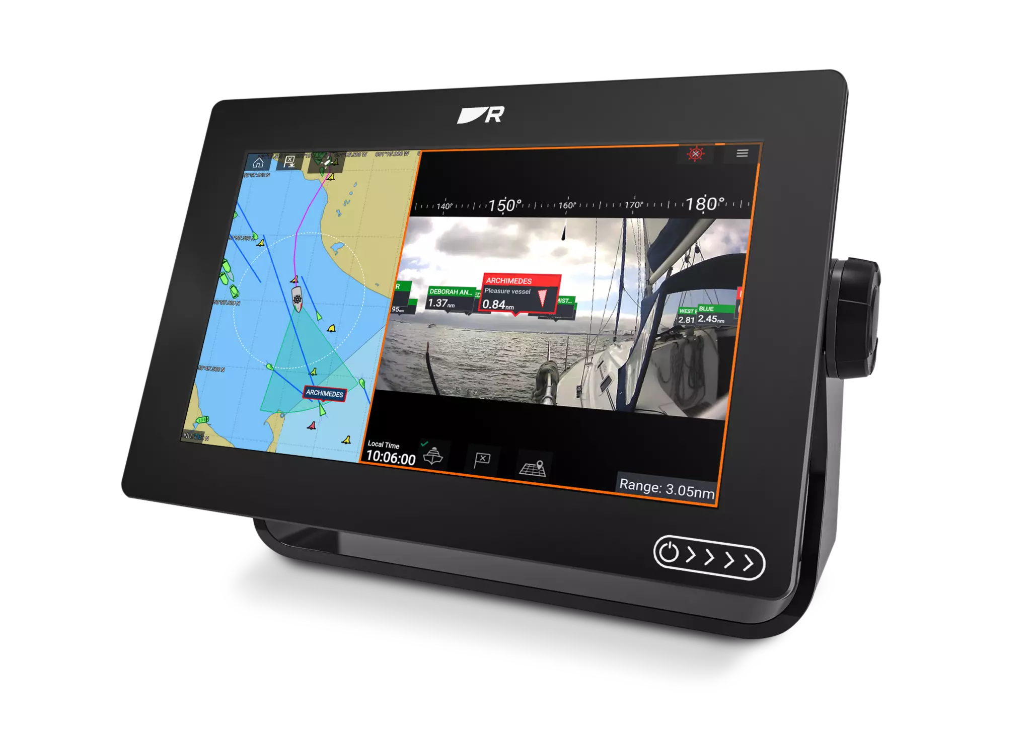
Dock-to-dock Route Guidance – Start your trip with a suggested dock-to-dock route.
Advanced Map Options – Customize your view to focus on the details that matter most.
Plotter Sync – Transfer routes and markers, update chart layers and more — between your compatible chartplotter and the Boating app.
SonarChart Live Mapping Feature – Watch new HD depth maps develop in real time as your boat moves through the water.
Coverage
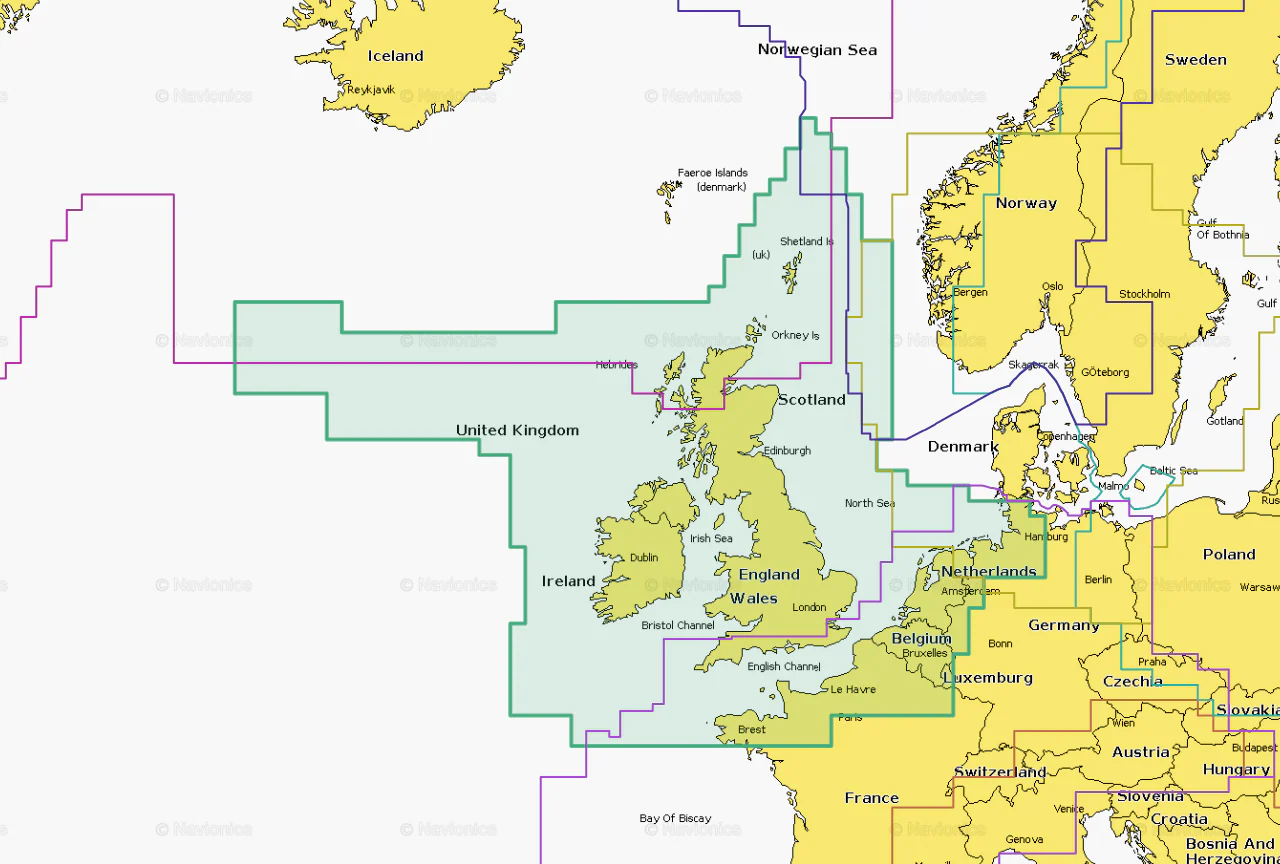
Worldwide map coverage is available, with integrated content making it easier to select the navigation features and map regions you want. Choose from large coverage areas (Large) to more localized chart cuts (Regular).
Compatibility
Check compatibility of Navionics+ content and features with your GPS
1 Subscription required.
2 Dock-to-dock Route Guidance is for planning purposes only and does not replace safe navigation operations.
3 Subscription not required for SonarChart Live mapping feature on some chartplotter models; requires latest chartplotter firmware release.
NOTE: Navionics+ and Platinum+ cards are not compatible with Garmin chartplotters.
Navionics+ cartography provides integrated offshore and inland marine mapping content with rivers, bays and more than 42,000 lakes around the world. This all-in-one solution offers clear, reliable cartography for the widest range of chartplotter brands.
One Year Subscription Included
A one-year subscription to Daily Updates and advanced features is included when you purchase any Navionics+ mapping solution. After a year, you can renew at a discounted price.
Charts and Updates
Nautical Chart – Comprehensive charts are derived from multiple official, government and private sources, displayed in a familiar look and feel.
SonarChart HD Bathymetry – Innovative 1' (0.5 m) bathymetry charts are created by using Navionics proprietary systems that augment existing content with sonar data contributed by the boating community.
Community Edits – Get useful local knowledge from edits made by users of the Navionics Boating app on your compatible smart device.
Daily Updates – Up to 5,000 daily updates to our charts give you the most accurate, most current data available.
Advanced Features
Dock-to-dock Route Guidance – Start your trip with a suggested dock-to-dock route.
Advanced Map Options – Customize your view to focus on the details that matter most.
Plotter Sync – Transfer routes and markers, update chart layers and more — between your compatible chartplotter and the Boating app.
SonarChart Live Mapping Feature – Watch new HD depth maps develop in real time as your boat moves through the water.
Coverage
Worldwide map coverage is available, with integrated content making it easier to select the navigation features and map regions you want. Choose from large coverage areas (Large) to more localized chart cuts (Regular).
Compatibility
Check compatibility of Navionics+ content and features with your GPS
1 Subscription required.
2 Dock-to-dock Route Guidance is for planning purposes only and does not replace safe navigation operations.
3 Subscription not required for SonarChart Live mapping feature on some chartplotter models; requires latest chartplotter firmware release.
NOTE: Navionics+ and Platinum+ cards are not compatible with Garmin chartplotters.
Select Size
From $91.36
Original: $304.53
-70%Navionics Chart Card—
$304.53
$91.36Product Information
Product Information
Shipping & Returns
Shipping & Returns
Description
Navionics Chart Card
Navionics+ cartography provides integrated offshore and inland marine mapping content with rivers, bays and more than 42,000 lakes around the world. This all-in-one solution offers clear, reliable cartography for the widest range of chartplotter brands.
One Year Subscription Included
A one-year subscription to Daily Updates and advanced features is included when you purchase any Navionics+ mapping solution. After a year, you can renew at a discounted price.
Charts and Updates
Nautical Chart – Comprehensive charts are derived from multiple official, government and private sources, displayed in a familiar look and feel.
SonarChart HD Bathymetry – Innovative 1' (0.5 m) bathymetry charts are created by using Navionics proprietary systems that augment existing content with sonar data contributed by the boating community.
Community Edits – Get useful local knowledge from edits made by users of the Navionics Boating app on your compatible smart device.
Daily Updates – Up to 5,000 daily updates to our charts give you the most accurate, most current data available.
Advanced Features
Dock-to-dock Route Guidance – Start your trip with a suggested dock-to-dock route.
Advanced Map Options – Customize your view to focus on the details that matter most.
Plotter Sync – Transfer routes and markers, update chart layers and more — between your compatible chartplotter and the Boating app.
SonarChart Live Mapping Feature – Watch new HD depth maps develop in real time as your boat moves through the water.
Coverage
Worldwide map coverage is available, with integrated content making it easier to select the navigation features and map regions you want. Choose from large coverage areas (Large) to more localized chart cuts (Regular).
Compatibility
Check compatibility of Navionics+ content and features with your GPS
1 Subscription required.
2 Dock-to-dock Route Guidance is for planning purposes only and does not replace safe navigation operations.
3 Subscription not required for SonarChart Live mapping feature on some chartplotter models; requires latest chartplotter firmware release.
NOTE: Navionics+ and Platinum+ cards are not compatible with Garmin chartplotters.